Home > Public Safety > 2021 GIS Day
FacebookLinkedInXPinterestEmail
Dark Mode

2021 GIS Day

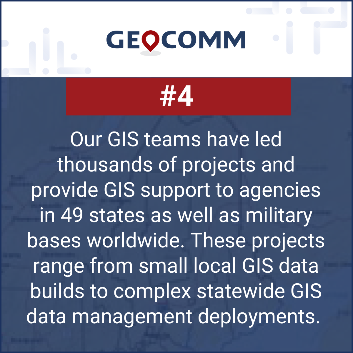
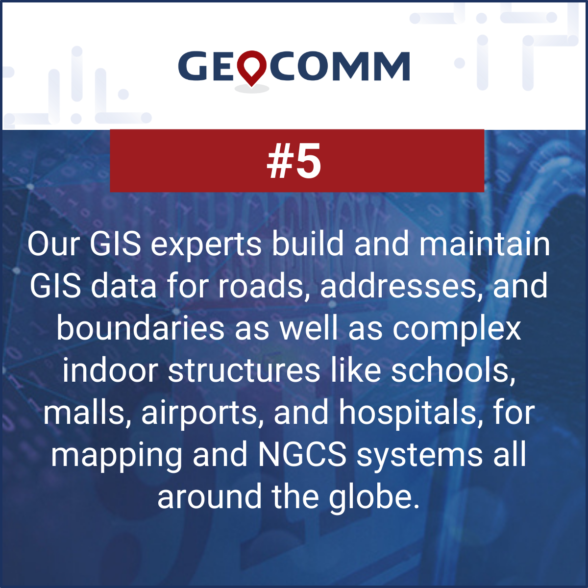
Today, in honor of 2021 GIS Day, we want to share some interesting facts about our team of dedicated GIS professionals. We appreciate our team working their hardest each day utilizing GIS technology and their GIS expertise to help our customers and thank all of the GIS professionals out there who use the power of GIS to improve lives.

November 17, 2021

GIS Resources

Don’t Wait for Data to Break: Manage Your GIS Data Proactively

Benjamin Franklin once observed, “Failing to plan is planning to fail.” While the origin of this quote is debated, its relevance remains indisputable—especially in the world of public safety. When it comes to 9-1-1 GIS data management, the message is clear: waiting for problems to appear before addressing them can have serious, even life-threatening, consequences. ...

Why GIS Data Goes Out of Date Fast – And How Public Safety Agencies Can Keep It Current

Why GIS Data Becomes Outdated — Especially in Public Safety How quickly does Public Safety GIS data go out of date? The answer is… almost immediately!  Let’s look at why this is the case, what the impacts to public safety are, and why effective GIS data management practices can ensure that your public safety GIS...

Indoor Maps vs. Floor Plans: 5 Reasons They’re Critical for Public Safety

Merriam-Webster’s Dictionary defines a floor plan as “a scale diagram of a room or suite of rooms viewed from above” and a map as “ a flat surface of the whole or a part of an area.”  But in the world of emergency response and public safety, what separates a traditional floor plan from a...