The Next Frontier of 9-1-1 Mapping – Indoors
Indoor mapping useful for emergency response starts with local high priority buildings.
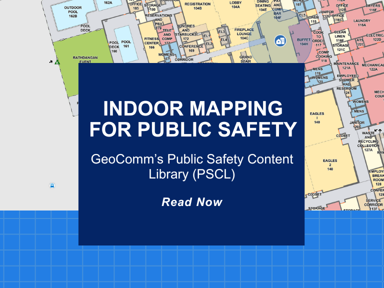
For many years the focus for Public Safety Grade GIS has been on site structure address points, road centerlines, service boundaries, and Public Safety Answering Point (PSAP) boundaries for routing 9-1-1 calls in a Next Generation 9-1-1 (NG9-1-1) systems. As we progress towards full NG9-1-1 implementations, having indoor context about the location of calls within indoor spaces will be critical for telecommunicators and first on scene responders. High quality, actionable indoor maps that are floor aware for visualization inside buildings for emergency response is the next frontier for Public Safety Grade GIS.
Statistics from 2018 state that 80% of 9-1-1 calls come from wireless devices. As well, a study conducted by the US Federal Government in 2019 stated that 80% of our time is spent indoors. Many 9-1-1 calls are initiated from indoor spaces with little information beyond the X,Y location that needs to be translated into a dispatchable address that the call is initiated from. Telecommunicators may see a dot on the map, but they do not have any context to where the call originated from. Is it coming from the third-floor restroom or the first-floor reception area? Adding indoor maps to your portfolio of additional GIS data information enables content with context.
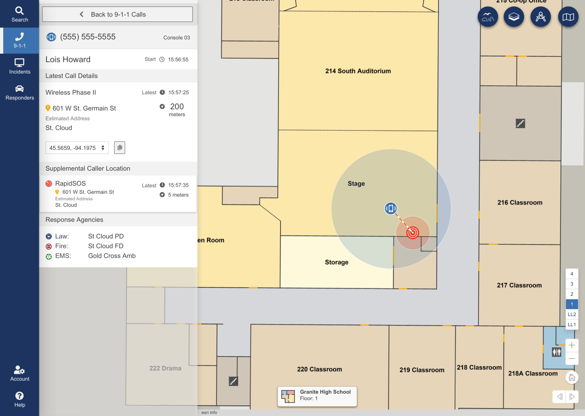
Mapping indoor spaces may seem like a project that is daunting and not something you wish to tackle. However, like site structure address points, road centerlines and service boundaries, indoor maps should be considered additional GIS data to enhance your overall enterprise. Starting with high priority buildings, such as schools, government facilities and then working with the community and businesses to add Public Safety Grade indoor maps to enhance safety and security is a logical progression.

Today most PSAPs that are receiving Z-axis information cannot use it as actionable data when responding to a 9-1-1 call. Understanding this information and making it actionable when calls are initiated from buildings that are more than one story is important for first responders. Floor awareness, along with the ability to calculate the relative elevation of a call based on the information coming in through the data stream as part of a 9-1-1 call and displaying that on an indoor map data set will help first responders to do their jobs more safely and effectively. When this happens there is a huge benefit to the rest of society.
Now, as you read this you may be asking yourself, where do I begin with an indoor maps project?
- As mentioned above, it is important to start with educating stake holders about the challenges faced in PSAP’s that do not have access to Public Safety Grade Indoor Maps.
- Along with educating key stake holders, determining key buildings to begin the conversion process will be important.
- Acquiring high quality copies of floor plans, in either PDF, DWG or high-resolution image formats that can be georeferenced to the earth surface and converted into GIS will be needed.
- Hand drawn or basic sketch images are not considered high enough of quality to be utilized for data conversion.
Mapping the locations of public safety assets within the buildings, such as fire extinguishers, Automated External Defibrillator’s (AEDs), camera locations and more also enhances the data conversion process. Geo-Comm Inc. (GeoComm) is equipped to assist agency’s achieve actionable location intelligence through indoor maps for enhanced situational awareness, reducing response times, and ultimately saving more lives during an indoor emergency situation. Get started today embracing the next frontier in public safety emergency response through the utilization of indoor maps.
Contact us to get started empowering your jurisdiction with indoor maps for key buildings in your response area.
