Latest GeoComm updates

GeoComm and StrataSite Partner to Help Schools Strengthen Preparedness and Improve Coordinated Response
Partnership connects trusted indoor mapping with coordinated response planning, training, and readiness tools to help schools and emergency responders align faster, reduce confusion, and act with greater confidence. ST. CLOUD, Minn., May 19, 2026 /PRNewswire/ — GeoComm, the provider of public-safety-grade location intelligence that underpins critical incident response, and StrataSite, a collaborative incident action planning solution, today...

How New Mexico Strengthened Emergency Response with Public Safety Grade GIS Data
Ensuring Accurate Location Data Across 100+ Local Governments. Overview In New Mexico, a largely rural state with vast geographic areas and limited emergency resources, even small GIS data errors can have life-threatening consequences. With more than 100 local government agencies contributing GIS data and over 40 Public Safety Answering Points (PSAPs) relying on that data...

GeoComm Indoor Mapping Integration with Zetron Help Strengthen Iowa Public Safety Response
Integration brings indoor building context into Zetron workflows to help public safety teams respond faster, coordinate more effectively, and improve situational awareness during indoor emergencies across Iowa. St. Cloud, Minn. – April 28, 2026 – GeoComm today announced an integration that brings GeoComm indoor mapping content into Zetron’s Map Viewer, helping support public safety agencies...
GeoComm and StrataSite Partner to Help Schools Strengthen Preparedness and Improve Coordinated Response
Partnership connects trusted indoor mapping with coordinated response planning, training, and readiness tools to help schools and emergency responders align faster, reduce confusion, and act with greater confidence. ST. CLOUD, Minn., May 19, 2026 /PRNewswire/ — GeoComm, the provider of public-safety-grade location intelligence that underpins critical incident response, and StrataSite, a collaborative incident action planning solution, today...
How New Mexico Strengthened Emergency Response with Public Safety Grade GIS Data
Ensuring Accurate Location Data Across 100+ Local Governments. Overview In New Mexico, a largely rural state with vast geographic areas and limited emergency resources, even small GIS data errors can have life-threatening consequences. With more than 100 local government agencies contributing GIS data and over 40 Public Safety Answering Points (PSAPs) relying on that data...
GeoComm Indoor Mapping Integration with Zetron Help Strengthen Iowa Public Safety Response
Integration brings indoor building context into Zetron workflows to help public safety teams respond faster, coordinate more effectively, and improve situational awareness during indoor emergencies across Iowa. St. Cloud, Minn. – April 28, 2026 – GeoComm today announced an integration that brings GeoComm indoor mapping content into Zetron’s Map Viewer, helping support public safety agencies...

Public Safety Location Intelligence: The Future of Emergency Response
Public safety location intelligence is becoming the foundation of modern emergency response. As 9-1-1 centers, law enforcement agencies, schools, and emergency response teams adopt new technologies like indoor mapping, artificial intelligence, drones as first responders, and real-time situational awareness platforms, one thing remains essential: accurate, trusted location data. Without it, even the most advanced public...
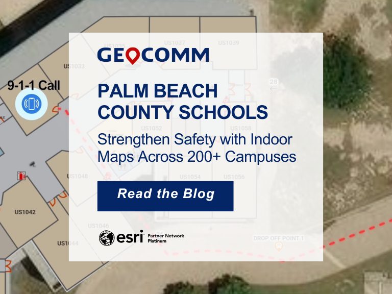
Palm Beach County Schools Strengthen Safety with Indoor Maps Across 200+ Campuses
Ensuring safety across a large school district requires more than traditional emergency plans. For the Palm Beach County School District, the tenth-largest school district in the United States, protecting students and staff means preparing for emergencies across hundreds of campuses and thousands of buildings. To strengthen situational awareness and emergency response, the district partnered with GeoComm to implement a...

GeoComm and Unknot.id Partner to Deliver Advanced Indoor Location Intelligence for Public Safety and Enterprise Environments
ST. CLOUD, Minn. and ORLANDO, Fla., April 14, 2026 – GeoComm and Unknot.id have partnered to bring public-safety-grade indoor location capabilities to public safety and enterprise environments where reliable, highly accurate maps and indoor positioning are mission critical. By extending trusted location awareness indoors, the partnership helps responders and facility teams navigate complex buildings more...
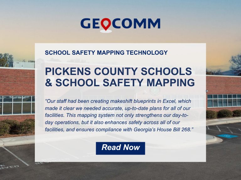
Pickens County School District Strengthens School Safety with GeoComm’s Interactive Indoor Mapping Solution
Pickens County, GA, April 2, 2026: Pickens County School District has taken a major step forward in enhancing school safety by implementing GeoComm’s School Safety mapping solution. Serving approximately 4,000 students across eight campuses, the school district partnered with GeoComm to map over 875,000 square feet of indoor space. The project was completed in just...

Where Insights Meet Action: Mapping at the Core of Public Safety Technology
At IWCE 2026, TJ Kennedy of GeoComm delivered a powerful keynote on why trusted, real-time location intelligence is essential to the future of public safety. As emergency response continues to evolve, accurate indoor and outdoor location data is becoming more important than ever. From strengthening situational awareness to improving responder coordination and supporting faster decision-making,...

How Iowa Built a Statewide School Safety Mapping Program
What does it take to protect every student, teacher, and staff member across an entire state? In Iowa, it started with a shared vision and the right partnerships to bring it to life. Through collaboration between state leaders, local school districts, GeoComm, and technology partner Esri, Iowa launched a first-of-its-kind statewide school safety mapping program....