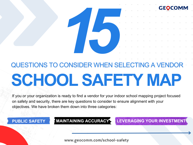
How Digital Geographic Information System Mapping Enhances Emergency Response
Why Digital Geographic Information System Mapping Matters
In an era where school safety and emergency preparedness are at the forefront of public concern, having precise, real-time, and actionable data is critical. Schools across the nation, including Minnesota, are facing increasing pressure to implement digital geographic information system mapping (GIS mapping) solutions to enhance emergency response and preparedness.
Traditional paper maps and static PDFs fail to provide the level of accuracy, real-time updates, and integration necessary for modern public safety operations. GeoComm, a leader in GIS data management and school safety mapping, is at the forefront of this transformation—helping Minnesota schools and public safety agencies adopt GIS-powered solutions to enhance safety and response times. Interested in learning more? Connect with your Regional Consultant
What is Digital Geographic Information System Mapping?
Digital Geographic Information System Mapping refers to the creation, visualization, and analysis of location-based data in an interactive digital format. Unlike static maps, GIS-based maps integrate real-time data layers, allowing schools and emergency responders to:
- Pinpoint exact locations within school buildings
- Track live emergency incidents for rapid response
- Integrate seamlessly with 9-1-1 and first responder systems
- Provide school administrators, dispatchers, and first responders with accurate spatial awareness
GeoComm specializes in converting raw GIS data into actionable intelligence, ensuring that Minnesota schools have the mapping solutions needed to meet new safety standards and funding requirements.
How GeoComm Supports Digital Geographic Information System Mapping for Schools
1. Accurate, GIS-Integrated School Safety Mapping
GeoComm’s school safety mapping solutions provide highly detailed indoor and outdoor maps of school campuses, ensuring first responders can quickly and efficiently locate students, staff, and emergency assets.
- Interactive Digital Maps – Move beyond outdated floor plans and adopt fully digital GIS maps that provide real-time insights.
- Emergency-Ready Mapping – Ensure 911 dispatch, fire, EMS, and law enforcement can instantly locate key access points, exits, and security assets.
- Live Data Integration – Seamlessly integrate GIS data with existing 9-1-1 systems to enhance emergency coordination.
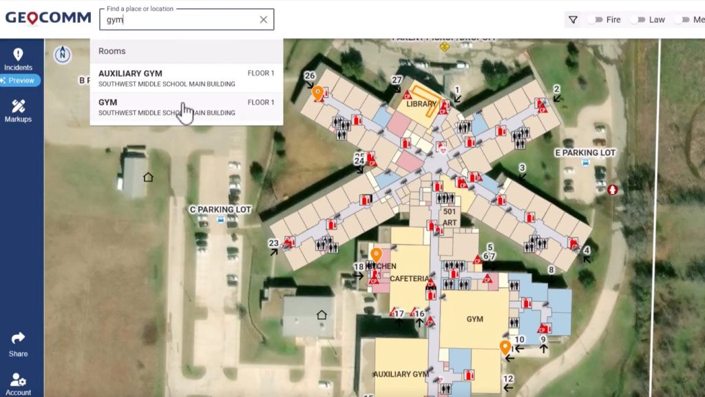
GeoComm’s critical incident mapping platform provides interactive school safety maps that integrate with 9-1-1 and emergency response systems. This GIS-based solution allows real-time comprehensive search for rooms, emergency assets, and critical locations within a school campus, ensuring rapid incident response and enhanced public safety coordination.
Example Use Case: In a medical emergency, a 9-1-1 dispatcher using GeoComm’s digital geographic information system mapping can immediately direct first responders to the exact room and nearest entrance—saving valuable time.
2. Meeting Minnesota’s School Safety Mapping Needs
With Minnesota’s push for enhanced school safety and upcoming state funding for GIS-based school mapping, it is critical for schools to have the right technology in place. GeoComm is uniquely positioned to help:
- Align with State & Federal Safety Mandates – GeoComm ensures that school mapping solutions meet compliance requirements and support grant eligibility.
- Speed & Accuracy – GeoComm’s team has mapped thousands of schools and can rapidly scale school mapping efforts across Minnesota.
- Funding Readiness – Many schools struggle to implement GIS solutions due to funding limitations. With upcoming Minnesota state funding for school safety, GeoComm helps districts prepare in advance so they can quickly take advantage of funding opportunities.

GeoComm’s digital geographic information system mapping technology enhances school safety by providing interactive GIS-based indoor maps. Shared Markups let you add and share critical safety labels–like medical stations, events, or temporary hazards–directly on your campus map. Designed for real-time response and compliance, these visual markers ensure everyone is on the same page. With built-in expiration dates, safety plans stay timely, accurate and clutter-free.
Key Benefits of Digital Geographic Information System Mapping for Schools
Adopting GIS mapping provides tangible benefits for schools, law enforcement, and emergency responders:
✔ Faster Emergency Response – Responders can instantly locate incidents, reducing delays.
✔ Improved Situational Awareness – GIS data offers a common operational picture for all agencies involved in an emergency.
✔ Seamless 9-1-1 Integration – GeoComm’s GIS maps sync with PSAP (Public Safety Answering Points) and first responder systems.
✔ State & Federal Compliance – Meet grant eligibility and school safety standards with NG911-ready GIS maps.
How Schools Can Get Started with GeoComm’s GIS Mapping Solutions
With Minnesota’s school safety funding on the horizon, now is the time for districts to prepare for digital geographic information system mapping implementation.
Schedule a Consultation – Speak with a GeoComm expert to assess your school’s mapping needs.
See how GIS data enhances critical incident mapping in 60 seconds
Learn more about GeoComm Critical Incident Mapping for School Safety