
Bring Data Expertise to your Agency
- Our experts are your people Save time and resources with GIS expert support – from identifying errors and data gaps to optimizing processes. We tackle the heavy lifting.
- Achieve data excellence Enhance your on-going data quality with standardization, deduplication, normalization and more to meet public safety requirements.

GIS Maintenance Services for Every Challenge
Free up resources, accelerate projects, and be confident in your GIS data.
- GIS expert support
- Save time and resources
- Comprehensive GIS data review and analysis
- Identify data errors and gaps
Lean on Our Team to do the Heavy Lifting
Our ongoing maintenance services provide the insights, tools, and support your team needs to achieve and sustain public safety data excellence.

“GeoComm GIS Services have transformed our data quality. We had errors in our analysis that they helped us fix, and the final product was better than we could have expected. ”
GIS Resources
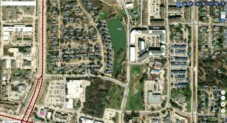
Southwest Minnesota: Digital Geographic Information System Mapping & 9-1-1 Emergency Response
Overview In 2023, the Southwest Minnesota Emergency Communications Board (SWECB) partnered with GeoComm to launch an indoor mapping pilot project. This digital geographic information system mapping initiative transformed critical infrastructure buildings into GIS-powered indoor maps, providing first responders with precise, real-time location intelligence and the school mapping data needed to ensure effective emergency response. The…
FCC NG9-1-1 Order: Progress, Challenges & What’s Next for Public Safety GIS
Where Are We Now in the NG9-1-1 Transition? On March 25, 2025, the Federal Communications Commission (FCC) issued a Public Notice announcing final approval by the U.S. Office of Management and Budget (OMB) of the FCC’s July 2024 Report and Order advancing the transition to Next Generation 9-1-1 (NG9-1-1). While this is a definite step…

NSGIC 3DEP FTN Interest Group Meeting
March 25, 2025 GeoComm Vertical Location Services: Enhancing Emergency Response with 3D Elevation Data When every second counts, knowing where an emergency caller is located—including their vertical position—is critical for first responders. GeoComm’s Vertical Location Services leverage digital elevation models to provide precise altitude data, helping emergency teams determine the correct floor, underground level, or…