


Eliminate Data Hosting Hassle with Web GIS Services
- Reliable and Easy to Use Ensure your GIS data is always available with uninterrupted access and 24/7 expert support, so you’re covered when it matters most.
- Reduce Operational Costs and Internal Resources Maximize your GIS data with secure, cost-effective hosting for real-time access, and resource efficiency.
Protected and Reliable
Streamline GIS hosting with seamless onboarding, a simple one-step data update process, and 24/7/365 support in a secure environment.
GIS Resources
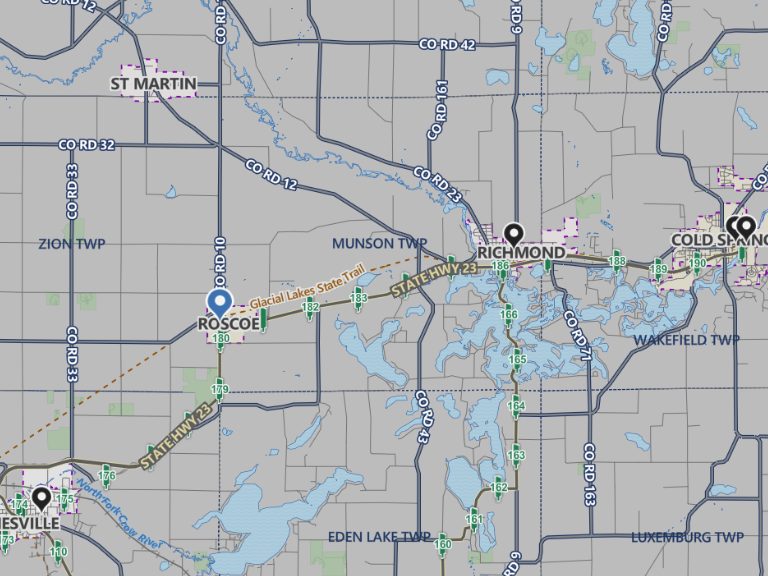
Southwest Minnesota: Digital Geographic Information System Mapping & 9-1-1 Emergency Response
Overview In 2023, the Southwest Minnesota Emergency Communications Board (SWECB) partnered with GeoComm to launch an indoor mapping pilot project. This digital geographic information system mapping initiative transformed critical infrastructure buildings into GIS-powered indoor maps, providing first responders with precise, real-time location intelligence and the school mapping data needed to ensure effective emergency response. The…
FCC NG9-1-1 Order: Progress, Challenges & What’s Next for Public Safety GIS
Where Are We Now in the NG9-1-1 Transition? On March 25, 2025, the Federal Communications Commission (FCC) issued a Public Notice announcing final approval by the U.S. Office of Management and Budget (OMB) of the FCC’s July 2024 Report and Order advancing the transition to Next Generation 9-1-1 (NG9-1-1). While this is a definite step…

NSGIC 3DEP FTN Interest Group Meeting
March 25, 2025 GeoComm Vertical Location Services: Enhancing Emergency Response with 3D Elevation Data When every second counts, knowing where an emergency caller is located—including their vertical position—is critical for first responders. GeoComm’s Vertical Location Services leverage digital elevation models to provide precise altitude data, helping emergency teams determine the correct floor, underground level, or…